22 Expected Number of Species
Last updated July 23, 2026
Description: Diversity metric from the Northeast Fisheries Science Center (NEFSC) Bottom Trawl Surveys.
Contributor(s): Sean Lucey, Andrew Beet, and Sarah Gaichas.
Affiliations: NEFSC
Indicator Family:
Indicator Category:
Synthesis Theme:
22.1 Introduction to Indicator
Diversity estimates have been developed to understand whether the overall structure of the ecosystem has remained stable or is changing. There are a large number of diversity indices that can be used to measure diversity; for the purposes of the State of the Ecosystem report we report on the expected number of species in a sample size (E(Sn)). These “rarefied” samples allow for comparisons between sample sites with varying number of species present. The estimate of (E(Sn) is less biased than other diversity indices which usually increase with sample size. It also has a more meaningful biological interpretation than other indices. For example, if a predator eats 10 random individuals,
E(Sn) will predict the number of species consumed.
22.2 Key Results and Visualizations
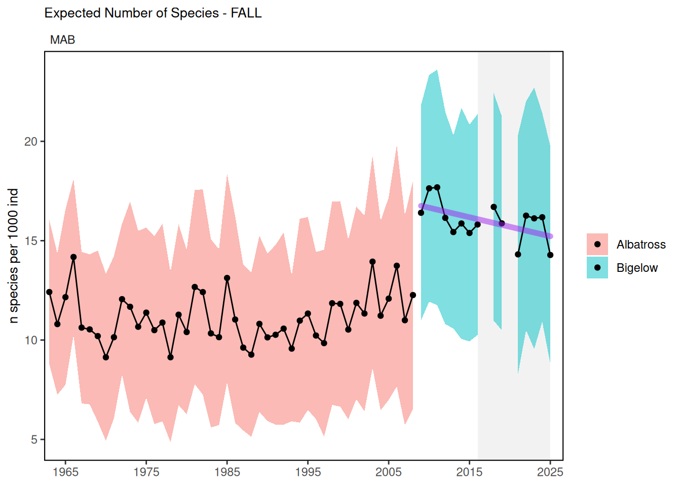
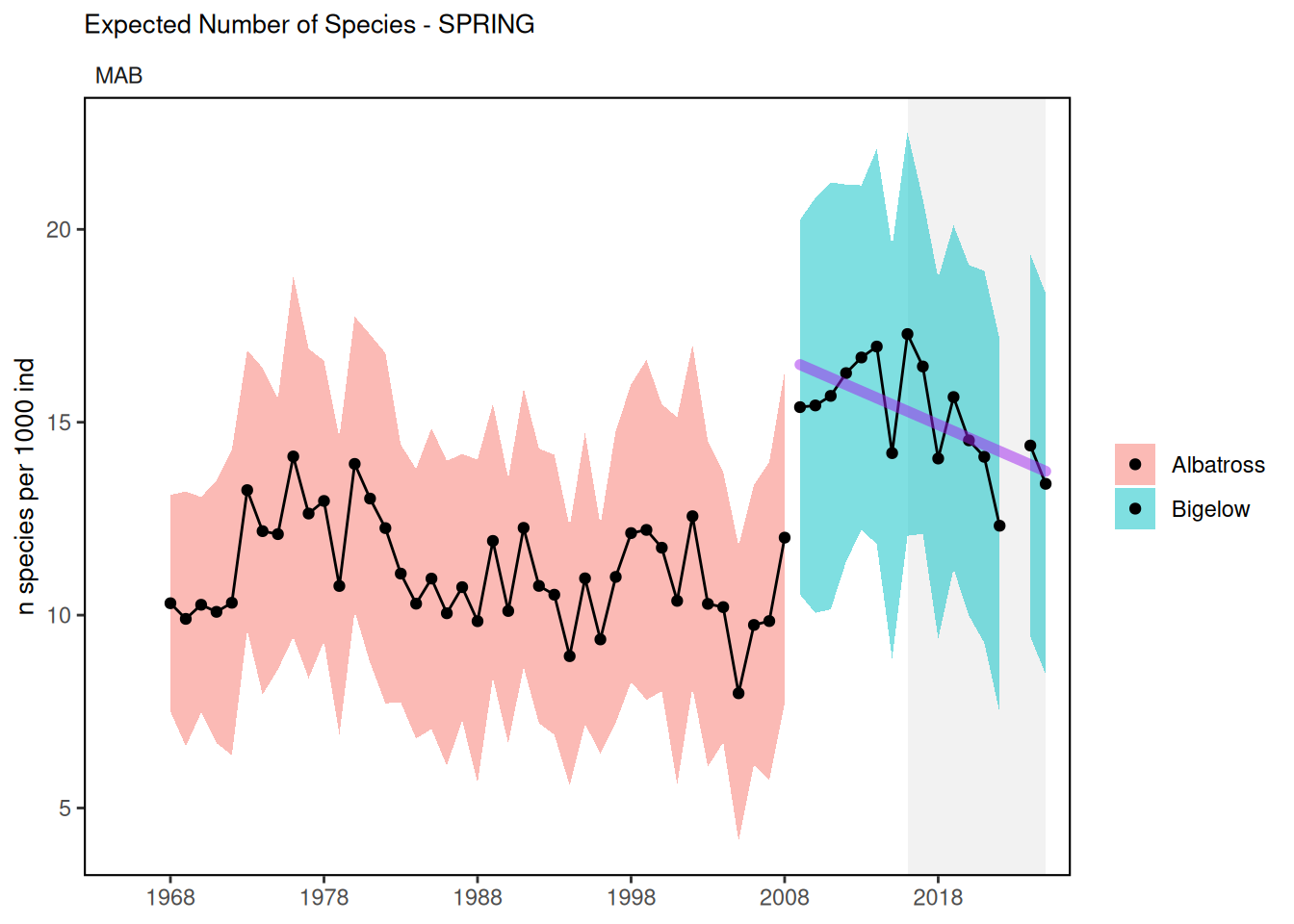
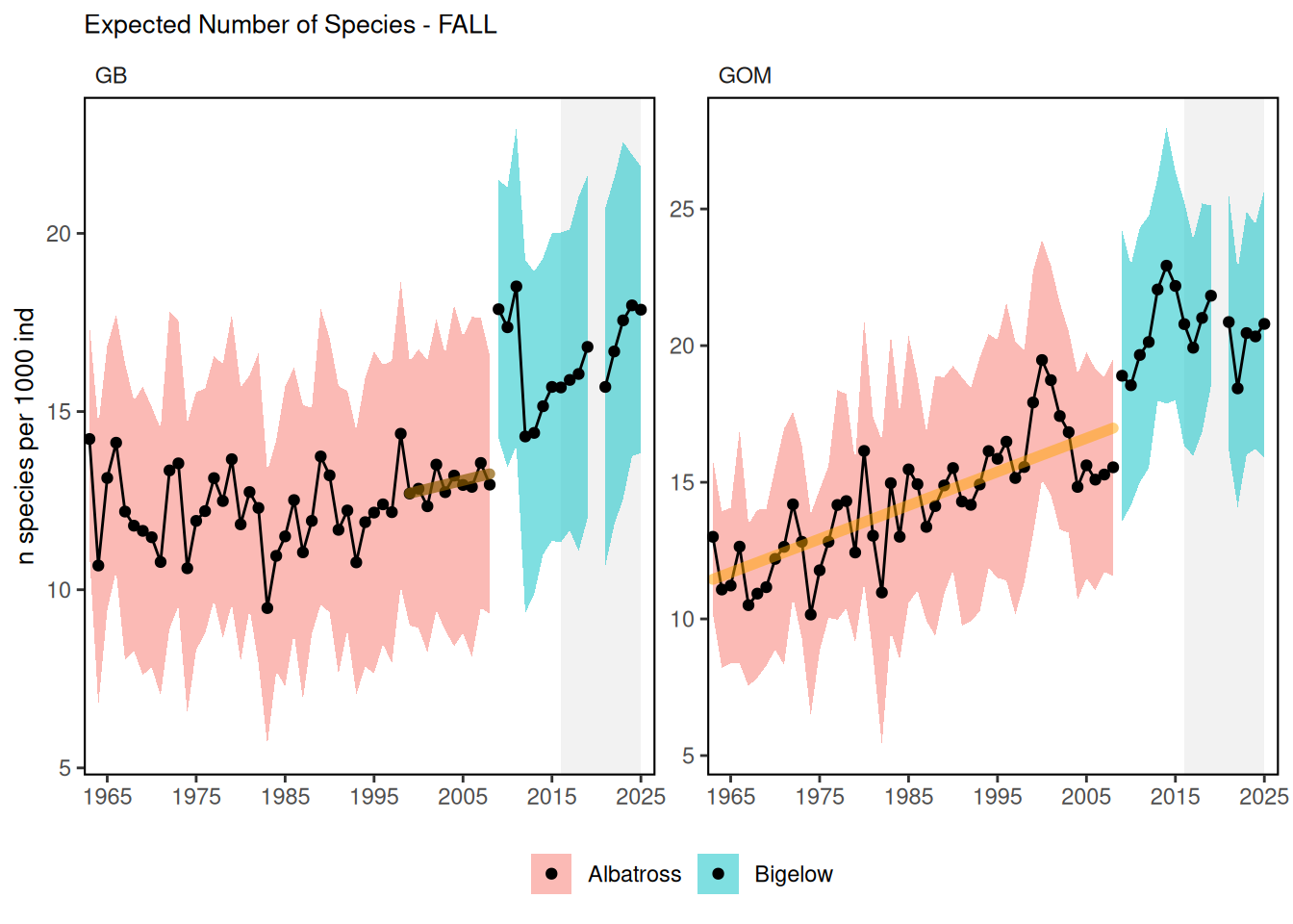
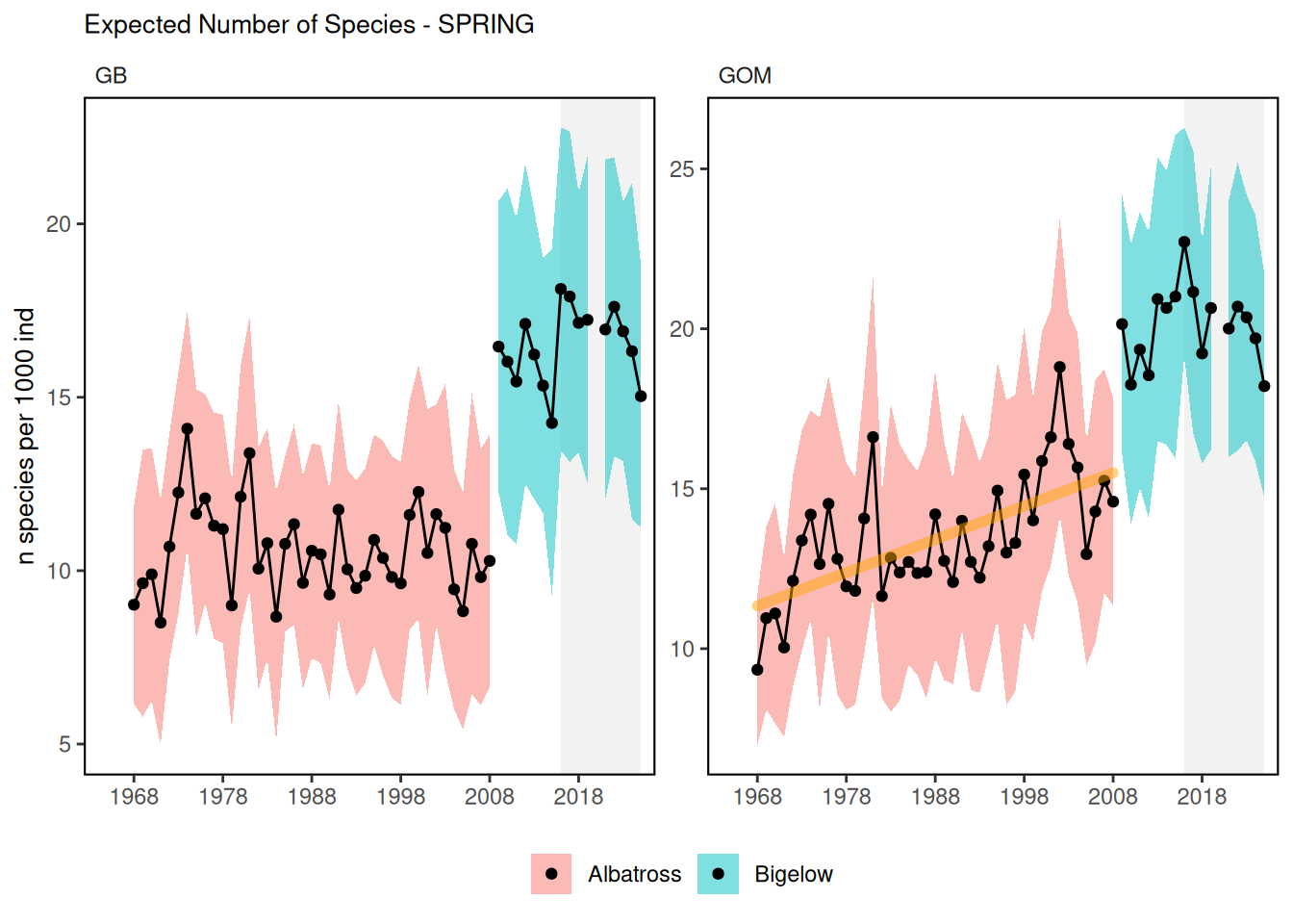
Due to the shift to the NOAA vessel Henry B. Bigelow in 2009 and the inability to correct for species composition, the time series is broken into Albatross and Bigelow stanzas. There is an apparent trend in the data from the Albatross time period in the Gulf of Maine. There is a declining trend in the Mid-Atlantic data from the spring Bigelow period.
fall, Mid-Atlantic
spring, Mid-Atlantic
fall, New England
spring, New England
22.3 Implications
Diversity is used as a proxy for stability. Changes in ecological diversity over time may indicate altered ecosystem structure with implications for fishery productivity and management [46]. This indicator shows that the underlying ecosystem is relatively stable with the possibility that the Gulf of Maine is becoming more diverse. Increasing adult diversity in the Gulf of Maine suggests an increase in warm-water species and should be closely monitored. Recent declining adult diversity in the Mid-Atlantic should also be closely monitored for management implications.
22.4 Indicator statistics
Spatial scale: By EPU
Temporal scale: Spring (March-May) and Fall (September-November)
Variable definitions
22.5 Get the data
Point of contact: EDAB, edab.data@noaa.gov
ecodata dataset: ecodata::exp_n
Tech Doc link: https://noaa-edab.github.io/tech-doc/exp_n.html