
42 Bottom Temperature - in situ
Last updated July 23, 2026
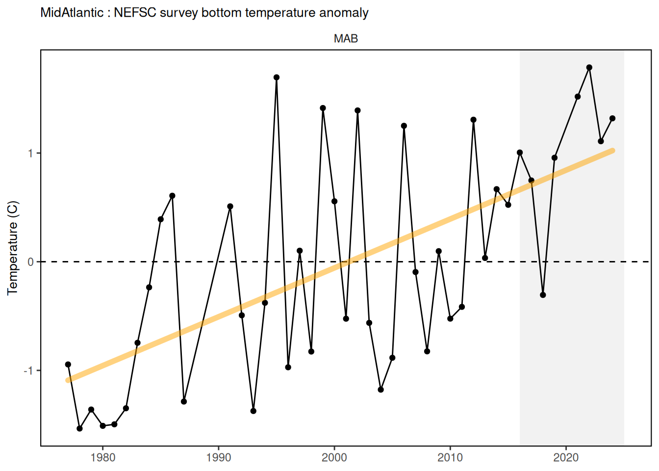
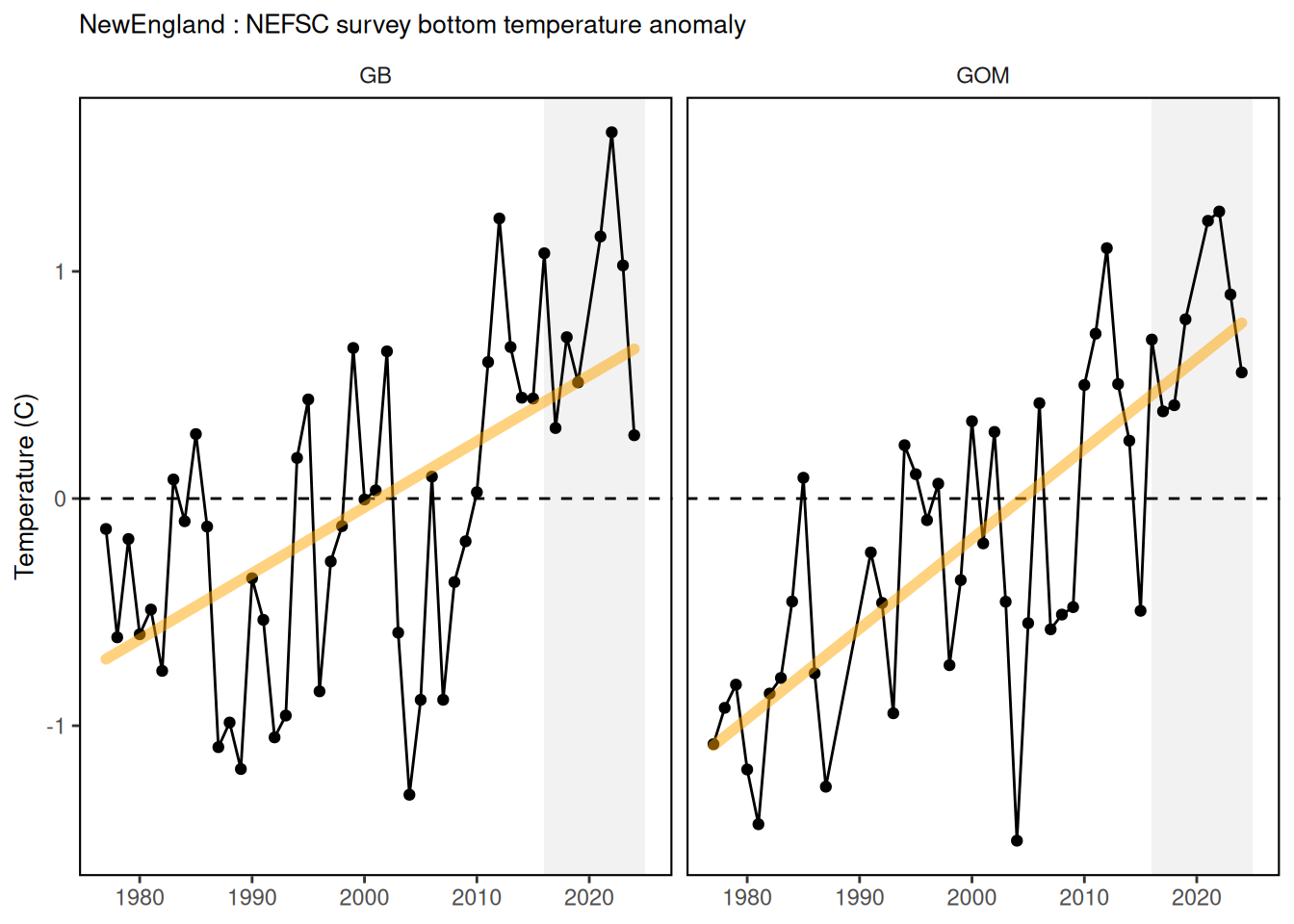
Description: The data presented here are time series of regional average bottom temperature anomalies from ship-based measurements made on the Northeast Continental Shelf.
Contributor(s): Paula Fratantoni; Chris Melrose; Tamara Holzwarth-Davis
Affiliations: NEFSC
Indicator Family:
Indicator Category:
Synthesis Theme:
42.1 Introduction to Indicator
The bottom temperature index incorporates near-bottom temperature measurements collected on Northeast Fisheries Science Center (NEFSC) surveys between 1977-present. Early measurements were made using surface bucket samples, mechanical bathythermographs and expendable bathythermograph probes, but by 1991 the CTD – an acronym for conductivity temperature and depth – became standard equipment on all NEFSC surveys. Near-bottom refers to the deepest observation at each station that falls within 10 m of the reported water depth. Observations encompass the entire continental shelf area extending from Cape Hatteras, NC to Nova Scotia, Canada, inclusive of the Gulf of Maine and Georges Bank.
42.5 Get the data
Point of contact: paula.fratantoni@noaa.gov
ecodata dataset: ecodata::bottom_temp_insitu
Tech Doc link: https://noaa-edab.github.io/tech-doc/bottom_temp_insitu.html